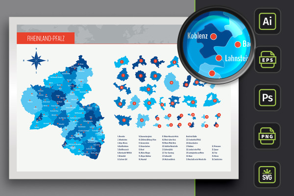
All of Rhineland-Palatinate on a beautifully designed map! Download the freely scalable maps and insert them into your layouts for print and web. Best of all, you can also display districts and independent cities individually. A map with highways is also included. And the locations of over 60 cities can be shown or hidden individually as required.
Map of Rhineland-Palatinate with maps of the 24 administrative districts and 12 independent cities
With markings of 68 cities that you can show and hide individually
Two designs per card: with borders as an outline and with varying colored areas, color customizable
Maps of Rhineland-Palatinate for Illustrator (AI), Photoshop (PSD), common vector programs such as Affinity Designer (EPS, SVG)
High-resolution PNG files for common editing programs
Whether flyer, brochure or website - the map of the federal state of Rhineland-Palatinate is now available to you at any time. Download now!
content
Details of the content
Map Rhineland-Palatinate
Map of Rhineland-Palatinate with counties and cities - colored areas
Download the map of Rhineland-Palatinate and you will immediately have access to the land areas of the entire federal state as well as the districts and independent cities. Use the maps, for example, to illustrate infographics or for location illustrations in web and print.
Map of Rhineland-Palatinate, including the maps of the 24 districts and 12 independent cities
Markings of 68 cities that can be shown and hidden individually
Modern design variant with areas varying in color - color customizable
Alphabetically sorted list to quickly find the desired region in Rhineland-Palatinate
Vector-based, freely scalable maps in AI format for Illustrator, in EPS and SVG format
Scalable PSD files for Photoshop
High-resolution PNG files for common editing programs
Editable in various programs, scalable and customizable in color - so you can add the whole of Rhineland-Palatinate to your designs.
Map of Rhineland-Palatinate with counties and cities - borders as contours
Get the map of Rhineland-Palatinate. The land areas of the entire federal state as well as the districts and independent cities are now available to you. Use the maps, for example, to illustrate infographics or for location illustrations in web and print.
Map of Rhineland-Palatinate, including the maps of the 24 districts and 12 independent cities
Markings of 68 cities, which can be shown and hidden individually
Design variant with borders as contours of the individual areas, color of the areas customizable
Alphabetically sorted list to quickly find the desired region in Rhineland-Palatinate
Vector-based, freely scalable maps in AI format for Illustrator, in EPS and SVG format
Scalable PSD files for Photoshop
High-resolution PNG files for common editing programs
Editable in various programs, scalable and customizable in color - add Rhineland-Palatinate to your designs.
Map of Rhineland-Palatinate with counties and cities - highways
Grab this map of Rhineland-Palatinate with depictions of the highways and use the maps to illustrate infographics or for location maps in web and print.
Map of Rhineland-Palatinate with the districts and independent cities as well as highways
Markings of 68 cities that can be shown and hidden individually
2 modern design variants: with colored areas and with borders as contours
Vector-based, freely scalable maps in AI format for Illustrator, in EPS and SVG format
Scalable PSD files for Photoshop
High-resolution PNG files for common editing programs
For various programs, scalable and customizable in color - this is how you add Rhineland-Palatinate to your designs.
Map of Rhineland-Palatinate with counties and cities - colored areas
Map of Rhineland-Palatinate with counties and cities - borders as contours
Map of Rhineland-Palatinate with counties and cities - highways
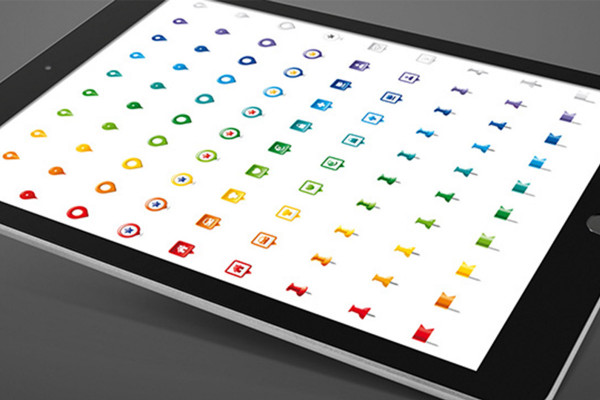
Bonus: Icons for marking
Icon set for marking locations on maps
Nine icons for displaying locations on maps:
10 color variants each
AI, EPS, PNG and SVG files
for Illustrator, Affinity Designer
for common vector and layout programs
Icon set for marking locations on maps
Examples of use
Open gallery
Create individual maps for your designs with the Rhineland-Palatinate map templates.
Open gallery
You can freely customize and edit the maps of Rhineland-Palatinate.
Open gallery
Show the whole of Rhineland-Palatinate or only selected regions.
Open gallery
You can show and hide the locations of the cities in Rhineland-Palatinate individually.
Open gallery
A map template with highways is also included in the package.
Open gallery
If you are working in Illustrator: Simply change the colors using color swatches.
Open gallery
The templates also offer you outstanding vector quality in Photoshop.
Open gallery
Use the icons also included to mark locations.
Comments (0)
Comment now „Map of Rhineland-Palatinate with counties“






 Create individual maps for your designs with the Rhineland-Palatinate map templates.
 You can freely customize and edit the maps of Rhineland-Palatinate.
 Show the whole of Rhineland-Palatinate or only selected regions.
 You can show and hide the locations of the cities in Rhineland-Palatinate individually.
 A map template with highways is also included in the package.
 If you are working in Illustrator: Simply change the colors using color swatches.
 The templates also offer you outstanding vector quality in Photoshop.
 Use the icons also included to mark locations.


Comment now „Map of Rhineland-Palatinate with counties“